
筠连县 topographic map
Interactive map
Click on the map to display elevation.
About this map
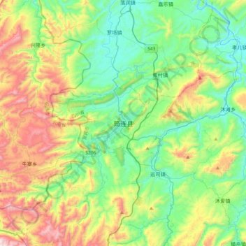
Name: 筠连县 topographic map, elevation, terrain.
Location: 筠连县, 宜宾市, 四川省, 645250, 中国 (28.00842 104.34764 28.32842 104.66764)
Average elevation: 2,349 ft
Minimum elevation: 1,158 ft
Maximum elevation: 4,934 ft
Other topographic maps
Click on a map to view its topography, its elevation and its terrain.