
High Catton topographic map
Click on the map to display elevation.
About this map
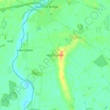
Name: High Catton topographic map, elevation, terrain.
Average elevation: 49 ft
Minimum elevation: 16 ft
Maximum elevation: 121 ft
Other topographic maps
Click on a map to view its topography, its elevation and its terrain.
Market Weighton
United Kingdom > England > East Riding of Yorkshire > Market Weighton
Average elevation: 141 ft
River Hull
United Kingdom > England > East Riding of Yorkshire > Brandesburton
Average elevation: 92 ft
Airedale
United Kingdom > England > East Riding of Yorkshire
Airedale, in conjunction with the Ribble Valley, provides low-altitude passes from Yorkshire to Lancashire through the Aire Gap. It is therefore an important transport route and was a strategically important area historically.
Average elevation: 197 ft
Stamford Bridge
United Kingdom > England > East Riding of Yorkshire > Stamford Bridge
Average elevation: 52 ft
Malton Lane Plantation
United Kingdom > England > East Riding of Yorkshire > Bugthorpe
Average elevation: 177 ft
Burton Constable Hall
United Kingdom > England > East Riding of Yorkshire > West Newton
Average elevation: 59 ft
Willerby and Derringham Flood Alleviation Scheme
United Kingdom > England > East Riding of Yorkshire > Kirk Ella
Average elevation: 138 ft
Full Sutton
United Kingdom > England > East Riding of Yorkshire > Full Sutton
Average elevation: 59 ft
Brantingham
United Kingdom > England > East Riding of Yorkshire > Brantingham
Average elevation: 167 ft
Burton Pidsea
United Kingdom > England > East Riding of Yorkshire > Burton Pidsea
Average elevation: 20 ft
Barmby on the Marsh
United Kingdom > England > East Riding of Yorkshire > Barmby on the Marsh
Average elevation: 13 ft
Bishop Burton
United Kingdom > England > East Riding of Yorkshire > Bishop Burton
Average elevation: 226 ft
Goodmanham
United Kingdom > England > East Riding of Yorkshire > Market Weighton
Average elevation: 285 ft
Barmby Moor
United Kingdom > England > East Riding of Yorkshire > Barmby Moor
Average elevation: 66 ft