Geolocate

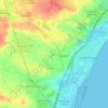
Faxe topographic map

Click on the map to display elevation.

About this map
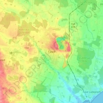
Name: Faxe topographic map, elevation, terrain.

Location: Faxe, Faxe Municipality, Region Zealand, 4640, Denmark (55.23212 12.09424 55.27212 12.13424)

Average elevation: 118 ft

Minimum elevation: 16 ft

Maximum elevation: 233 ft

Other topographic maps

Click on a map to view its topography, its elevation and its terrain.
Lammefjorden

Denmark > Region Zealand > Gundestrup

The draining project began in 1873, but it took until 1943 before the lowest elevations were pumped dry. Large parts of the fjord were shallow enough to be dry early on. In 1899 the Odsherred Railway opened across the western end of the fjord. The town of Fårevejle Stationsby grew up where the railway…

Average elevation: 33 ft
Møns Klint

Denmark > Region Zealand

Average elevation: 121 ft

Møn

Denmark > Region Zealand

Average elevation: 13 ft

Odsherred Municipality

Denmark > Region Zealand

Average elevation: 23 ft

Slagelse

Denmark > Region Zealand > Slagelse

Average elevation: 154 ft

Havnebyen

Denmark > Region Zealand

Average elevation: 3 ft

Solrød Municipality

Denmark > Region Zealand

Average elevation: 62 ft

Gear up for your next adventure:

🪶Wildlife Field Guides - Learn animal tracking and species ID
🌎3D Topographic Globes - Raised relief globes for a tactile understanding of geography
📶Vehicle Signal Boosters - Improve reception in rural areas while driving to trailheads
🛰️Satellite Messengers - Emergency SOS and two-way messaging for off-grid adventures
👖Convertible Hiking Pants - Versatile zip-off pants for changing altitudes and temperatures

As an Amazon Associate, this site earns from qualifying purchases at no extra cost to you.