
Quay topographic map
Interactive map
Click on the map to display elevation.
About this map
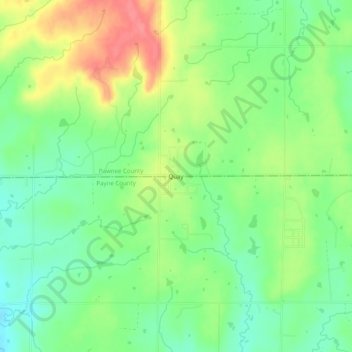
Name: Quay topographic map, elevation, terrain.
Location: Quay, Pawnee County, Oklahoma, United States (36.13951 -96.73086 36.17951 -96.69086)
Average elevation: 925 ft
Minimum elevation: 827 ft
Maximum elevation: 1,066 ft
Other topographic maps
Click on a map to view its topography, its elevation and its terrain.
Terlton
United States > Oklahoma > Pawnee County > Terlton
Terlton, Pawnee County, Oklahoma, 74081, United States
Average elevation: 833 ft
Maramec
United States > Oklahoma > Pawnee County > Maramec
Maramec, Pawnee County, Oklahoma, 74045, United States
Average elevation: 961 ft
Cleveland
United States > Oklahoma > Pawnee County
Cleveland, Pawnee County, Oklahoma, United States
Average elevation: 807 ft