
Make a donation
Gear up for your next adventure:
As an Amazon Associate, this site earns from qualifying purchases at no extra cost to you.
Northview topographic map
Click on the map to display elevation.
Make a donation
Gear up for your next adventure:
As an Amazon Associate, this site earns from qualifying purchases at no extra cost to you.
About this map
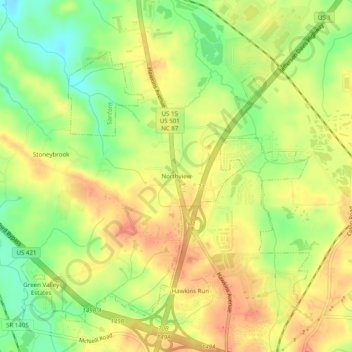
Name: Northview topographic map, elevation, terrain.
Location: Northview, Lee County, North Carolina, 27330, United States (35.50904 -79.20585 35.54904 -79.16585)
Average elevation: 308 ft
Minimum elevation: 210 ft
Maximum elevation: 377 ft
Lee County trails, hiking, mountain biking, running and outdoor activities
Make a donation
Gear up for your next adventure:
As an Amazon Associate, this site earns from qualifying purchases at no extra cost to you.
Other topographic maps
Click on a map to view its topography, its elevation and its terrain.
City of Sanford
United States > North Carolina > Lee County > City of Sanford
Average elevation: 377 ft