
Thank you for supporting this site ❤️
Make a donation
Make a donation
Gear up for your next adventure:
As an Amazon Associate, this site earns from qualifying purchases at no extra cost to you.
Vodice topographic map
Click on the map to display elevation.
Thank you for supporting this site ❤️
Make a donation
Make a donation
Gear up for your next adventure:
As an Amazon Associate, this site earns from qualifying purchases at no extra cost to you.
About this map
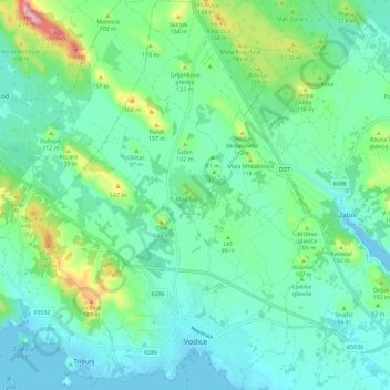
Name: Vodice topographic map, elevation, terrain.
Location: Vodice, Grad Vodice, Šibenik-Knin County, 22100, Croatia (43.74984 15.73503 43.83247 15.81129)
Average elevation: 187 ft
Minimum elevation: -23 ft
Maximum elevation: 846 ft
Thank you for supporting this site ❤️
Make a donation
Make a donation
Gear up for your next adventure:
As an Amazon Associate, this site earns from qualifying purchases at no extra cost to you.