
Make a donation
Gear up for your next adventure:
As an Amazon Associate, this site earns from qualifying purchases at no extra cost to you.
Fort Hall topographic map
Click on the map to display elevation.
Make a donation
Gear up for your next adventure:
As an Amazon Associate, this site earns from qualifying purchases at no extra cost to you.
About this map
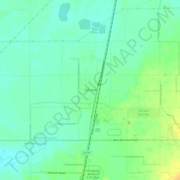
Name: Fort Hall topographic map, elevation, terrain.
Location: Fort Hall, Bingham County, Idaho, 83203, United States (43.01325 -112.45831 43.05325 -112.41831)
Average elevation: 4,449 ft
Minimum elevation: 4,416 ft
Maximum elevation: 4,505 ft
Bingham County trails, hiking, mountain biking, running and outdoor activities
Make a donation
Gear up for your next adventure:
As an Amazon Associate, this site earns from qualifying purchases at no extra cost to you.
Other topographic maps
Click on a map to view its topography, its elevation and its terrain.
Aberdeen
United States > Idaho > Bingham County
Aberdeen is located at 42°56′36″N 112°50′22″W / 42.94333°N 112.83944°W / 42.94333; -112.83944 (42.943405, -112.839322), at an elevation of 4,403 feet (1,342 m) above sea level. According to the United States Census Bureau, the city has a total area of 1.03 square miles (2.67 km2), all of it land.
Average elevation: 4,400 ft
Make a donation
Gear up for your next adventure:
As an Amazon Associate, this site earns from qualifying purchases at no extra cost to you.