
Cedarhill topographic map
Interactive map
Click on the map to display elevation.
About this map
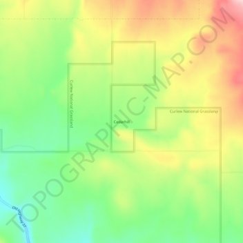
Name: Cedarhill topographic map, elevation, terrain.
Location: Cedarhill, Oneida County, Idaho, United States (42.24686 -112.75137 42.28686 -112.71137)
Average elevation: 5,417 ft
Minimum elevation: 5,095 ft
Maximum elevation: 5,814 ft
Other topographic maps
Click on a map to view its topography, its elevation and its terrain.
Malad City
United States > Idaho > Oneida County
Malad City, Oneida County, Idaho, United States
Average elevation: 4,613 ft
Malad
United States > Idaho > Oneida County
Malad, Malad City, Oneida County, Idaho, United States
Average elevation: 4,813 ft