
Flora topographic map
Click on the map to display elevation.
About this map
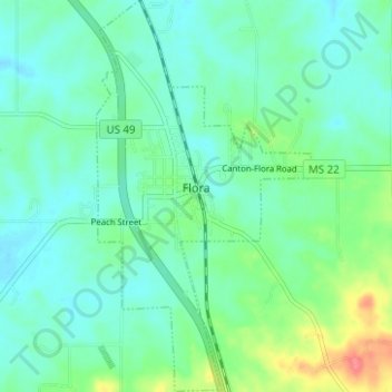
Name: Flora topographic map, elevation, terrain.
Location: Flora, Madison County, Mississippi, 39071, United States (32.51591 -90.32539 32.56850 -90.29117)
Average elevation: 246 ft
Minimum elevation: 194 ft
Maximum elevation: 413 ft
Madison County trails, hiking, mountain biking, running and outdoor activities
Other topographic maps
Click on a map to view its topography, its elevation and its terrain.
Traceland North
United States > Mississippi > Madison County > Madison > Traceland North
Average elevation: 335 ft