Geolocate

Mackay topographic map

Click on the map to display elevation.

About this map
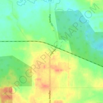
Name: Mackay topographic map, elevation, terrain.

Location: Mackay, Division No. 14, Alberta, Canada (53.62262 -115.60526 53.66262 -115.56526)

Average elevation: 2,654 ft

Minimum elevation: 2,595 ft

Maximum elevation: 2,740 ft

Gear up for your next adventure:

🚑Emergency Bivvies - Heat-reflective sleeping bags for survival situations
🌎3D Topographic Globes - Raised relief globes for a tactile understanding of geography
🧭Map Reading Tools - Tools and kits for map navigation
🪓Survival Multi‑Tool - Versatile tool for camp and trail tasks
🌲Outdoor Survival Books - Best books on survival skills

As an Amazon Associate, this site earns from qualifying purchases at no extra cost to you.