Geolocate

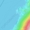
Pazzon topographic map

Click on the map to display elevation.

About this map

Name: Pazzon topographic map, elevation, terrain.

Location: Pazzon, Caprino Veronese, Verona, Veneto, 37013, Italy (45.59898 10.80579 45.63898 10.84579)

Average elevation: 1,644 ft

Minimum elevation: 308 ft

Maximum elevation: 4,219 ft

Other topographic maps

Click on a map to view its topography, its elevation and its terrain.

Brenzone sul Garda

Italy > Veneto > Verona

Average elevation: 2,241 ft

Lazise

Italy > Veneto > Verona

Average elevation: 331 ft

Bardolino

Italy > Veneto > Verona > Bardolino

Average elevation: 384 ft

Sommacampagna

Italy > Veneto > Verona

Average elevation: 295 ft

Mozzecane

Italy > Veneto > Verona

Average elevation: 154 ft

Cerea

Italy > Veneto > Verona

Average elevation: 46 ft

Nogara

Italy > Veneto > Verona

Average elevation: 62 ft

Sant'Anna d'Alfaedo

Italy > Veneto > Verona

Average elevation: 2,743 ft

Colognola ai Colli

Italy > Veneto > Verona

Average elevation: 213 ft

Isola del Sogno

Italy > Veneto > Verona > Cassone

Average elevation: 499 ft

Minerbe

Italy > Veneto > Verona

Average elevation: 52 ft

Veronella

Italy > Veneto > Verona

Average elevation: 69 ft

Gear up for your next adventure:

🛠️Backpacking Tool Kit - Essential toolkit for outdoor repairs
🌎3D Topographic Globes - Raised relief globes for a tactile understanding of geography
🧯Emergency Survival Kit - All‑in‑one survival essentials for the backcountry
🕶️Glacier Sunglasses - Side shields to protect eyes from high-altitude snow glare
🧥Waterproof Jacket for Hiking - Breathable and rugged rain jacket for outdoor excursions

As an Amazon Associate, this site earns from qualifying purchases at no extra cost to you.