Geolocate

Veronella topographic map

Click on the map to display elevation.

About this map

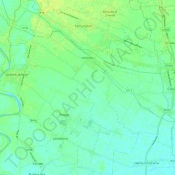
Name: Veronella topographic map, elevation, terrain.

Location: Veronella, Verona, Veneto, 37040, Italy (45.26929 11.26847 45.35228 11.35706)

Average elevation: 69 ft

Minimum elevation: 49 ft

Maximum elevation: 98 ft

Other topographic maps

Click on a map to view its topography, its elevation and its terrain.

Spiazzi

Italy > Veneto > Verona

Average elevation: 2,326 ft

Santa Margherita

Italy > Veneto > Verona

Average elevation: 915 ft

Pezzo

Italy > Veneto > Verona > Bosco Chiesanuova

Average elevation: 3,563 ft

Casale

Italy > Veneto > Verona > San Martino Buon Albergo

Average elevation: 623 ft

Villaggio Monte Cucco

Italy > Veneto > Verona > Ferrara di Monte Baldo

Average elevation: 2,884 ft

Pazzon

Italy > Veneto > Verona

Average elevation: 1,644 ft

Bosco

Italy > Veneto > Verona > Presina

Average elevation: 66 ft

Provalo

Italy > Veneto > Verona > Sant'Anna d'Alfaedo

Average elevation: 3,215 ft

Masetti

Italy > Veneto > Verona > San Bonifacio

Average elevation: 85 ft

Azzano

Italy > Veneto > Verona > Castel d'Azzano

Average elevation: 154 ft

Isola del Sogno

Italy > Veneto > Verona > Cassone

Average elevation: 499 ft

Sengie

Italy > Veneto > Verona > Grezzana > Lugo

Average elevation: 1,759 ft

Miega

Italy > Veneto > Verona > Veronella > Miega

Average elevation: 62 ft

Cavalcaselle

Italy > Veneto > Verona > Cavalcaselle

Average elevation: 315 ft

Gear up for your next adventure:

🌐World Map Poster - Decorative world maps with topographic info
🌡️Portable Weather Meter - Track weather conditions on the trail
Camping Coffee Makers - Enjoy premium coffee at the summit or campsite
🔋Rechargeable Batteries - Power up your outdoor devices
🧥Men's Rain Shells - Premium waterproof and breathable jackets for mountain weather

As an Amazon Associate, this site earns from qualifying purchases at no extra cost to you.