Geolocate

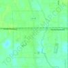
Friendship topographic map

Click on the map to display elevation.

About this map

Name: Friendship topographic map, elevation, terrain.

Location: Friendship, Livingston Parish, Louisiana, United States (30.56269 -90.89093 30.60269 -90.85093)

Average elevation: 72 ft

Minimum elevation: 46 ft

Maximum elevation: 98 ft

Other topographic maps

Click on a map to view its topography, its elevation and its terrain.

Walker

United States > Louisiana > Livingston Parish

Average elevation: 39 ft

Albany

United States > Louisiana > Livingston Parish

Average elevation: 39 ft

Albany

United States > Louisiana > Livingston Parish

Average elevation: 39 ft

Gear up for your next adventure:

🧭Outdoor Navigation Book - Learn advanced navigation skills
📚Navigation Handbooks - Master the art of reading topographic maps and using a compass
🧷Carabiner Set - Durable clips for gear attachment
🧭Hiking Compass - Precision compass for reliable navigation in the wilderness
🔦LED Headlamp - Bright and durable LED headlamp for night navigation

As an Amazon Associate, this site earns from qualifying purchases at no extra cost to you.