Geolocate

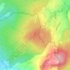
Stockhausen topographic map

Click on the map to display elevation.

About this map

Name: Stockhausen topographic map, elevation, terrain.

Location: Stockhausen, Herbstein, Vogelsbergkreis, Hesse, 36358, Germany (50.53200 9.37813 50.58122 9.49777)

Average elevation: 1,257 ft

Minimum elevation: 833 ft

Maximum elevation: 1,627 ft

Other topographic maps

Click on a map to view its topography, its elevation and its terrain.

Schmitten

Germany > Hesse > Vogelsbergkreis > Sellnrod

Average elevation: 1,257 ft

Dick

Germany > Hesse > Vogelsbergkreis

Average elevation: 1,240 ft

Lauterbach

Germany > Hesse > Vogelsbergkreis

Average elevation: 1,184 ft

Gear up for your next adventure:

📡Handheld GPS Device - Reliable handheld GPS for outdoor navigation
🌧️Backpack Rain Cover - Keep gear dry in wet weather
🩹Survival Bandages - High‑quality bandages for emergencies
📖Nature Tracking Books - Learn to track wildlife and terrain
📦Gear Storage Bags - Organize and protect outdoor equipment

As an Amazon Associate, this site earns from qualifying purchases at no extra cost to you.