Geolocate

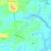
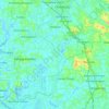
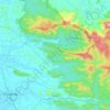
Karikulam topographic map

Click on the map to display elevation.

About this map

Name: Karikulam topographic map, elevation, terrain.

Location: Karikulam, Chalakkudy, Thrissur, Kerala, India (10.40044 76.36670 10.44044 76.40670)

Average elevation: 148 ft

Minimum elevation: 33 ft

Maximum elevation: 617 ft

Other topographic maps

Click on a map to view its topography, its elevation and its terrain.
Kuzhur

India > Kerala > Chalakkudy > Valiyaparambu

Average elevation: 23 ft

Kakkulissery

India > Kerala > Chalakkudy > Valiyaparambu

Average elevation: 33 ft

Thiruthiparambu East

India > Kerala > Chalakkudy > Chalakudy

Average elevation: 33 ft

Athirappilly

India > Kerala > Chalakkudy

Average elevation: 1,332 ft

Kadukutty

India > Kerala > Chalakkudy > Sampaloor

Average elevation: 26 ft

Nandipulam

India > Kerala > Chalakkudy

Average elevation: 52 ft

St James Hospital

India > Kerala > Chalakkudy > Chalakudy

Average elevation: 46 ft

Lower Sholayar Dam

India > Kerala > Chalakkudy

Average elevation: 2,536 ft

Muniyattukunnu Hill lock

India > Kerala > Chalakkudy > Kannatupadam

Average elevation: 121 ft

Chalakudy River

India > Kerala > Chalakkudy > Kizhake Chalakudi

Average elevation: 43 ft

Mattathur

India > Kerala > Chalakkudy > Kodaly

Average elevation: 653 ft

St James Hospital

India > Kerala > Chalakkudy > Chalakudy

Average elevation: 46 ft

Gear up for your next adventure:

🦺Reflective Outdoor Gear - Safety gear for low‑light conditions
🔥Camping Stove - Portable stove for camping and backcountry cooking
🌡️Handheld Weather Meters - Measure wind, temp, and pressure for safe mountain travel
📶Satellite Messenger - Communication device off‑grid
🗺️NatGeo Topo Maps - High-quality waterproof printed topographic maps of US Parks

As an Amazon Associate, this site earns from qualifying purchases at no extra cost to you.