Geolocate

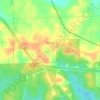
Trammel Crossroads topographic map

Click on the map to display elevation.

About this map

Name: Trammel Crossroads topographic map, elevation, terrain.

Location: Trammel Crossroads, Chambers County, Alabama, United States (32.95124 -85.55523 32.99124 -85.51523)

Average elevation: 689 ft

Minimum elevation: 587 ft

Maximum elevation: 801 ft

Chambers County trails, hiking, mountain biking, running and outdoor activities

Other topographic maps

Click on a map to view its topography, its elevation and its terrain.

Five Points

United States > Alabama > Chambers County

Average elevation: 827 ft

Cusseta

United States > Alabama > Chambers County

Average elevation: 696 ft

Waverly

United States > Alabama > Chambers County

Average elevation: 735 ft

Lanett

United States > Alabama > Chambers County

Average elevation: 640 ft

Valley

United States > Alabama > Chambers County

Average elevation: 627 ft

LaFayette

United States > Alabama > Chambers County

Average elevation: 791 ft

Huguley

United States > Alabama > Chambers County > Huguley

Average elevation: 673 ft

Gear up for your next adventure:

🔭Telescopic Hiking Pole - Adjustable pole for hiking stability
🧭Compass with Lanyard - Easy‑carry compass for navigation
🪶Wildlife Field Guides - Learn animal tracking and species ID
🏫Relief Map Kits - Hands-on tools for teaching landforms and elevation
🚪Portable Camp Chair - Foldable chair for comfort at camp

As an Amazon Associate, this site earns from qualifying purchases at no extra cost to you.