Geolocate

Kfour topographic map

Click on the map to display elevation.

About this map

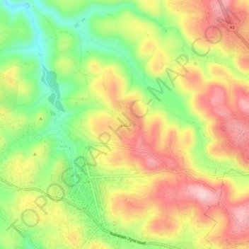
Name: Kfour topographic map, elevation, terrain.

Location: Kfour, Nabatieh District, Nabatieh Governorate, 1700, Lebanon (33.37832 35.43179 33.41832 35.47179)

Average elevation: 1,325 ft

Minimum elevation: 922 ft

Maximum elevation: 1,699 ft

Other topographic maps

Click on a map to view its topography, its elevation and its terrain.

Nabatiyeh El Fawqa

Lebanon > Nabatieh Governorate

Average elevation: 1,555 ft

Khiam

Lebanon > Nabatieh Governorate

Average elevation: 1,703 ft

Klayaa

Lebanon > Nabatieh Governorate

Average elevation: 1,706 ft

Meiss Ej-Jabal

Lebanon > Nabatieh Governorate

Average elevation: 2,067 ft

Chaqra

Lebanon > Nabatieh Governorate

Average elevation: 2,087 ft

Marjayoun District

Lebanon > Nabatieh Governorate

Average elevation: 1,427 ft

Gear up for your next adventure:

👖Convertible Hiking Pants - Versatile zip-off pants for changing altitudes and temperatures
📡GPS Antenna Upgrade - Enhance GPS reception in remote terrain
🔪Outdoor Multitools - Essential survival tools for gear repair and field use
📦Gear Storage Bags - Organize and protect outdoor equipment
🔥Fast-Boil Camping Stoves - Efficient cooking systems for quick trail meals

As an Amazon Associate, this site earns from qualifying purchases at no extra cost to you.