Geolocate

Klayaa topographic map

Click on the map to display elevation.

About this map

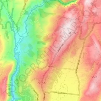
Name: Klayaa topographic map, elevation, terrain.

Location: Klayaa, Marjayoun District, Nabatieh Governorate, Lebanon (33.30968 35.53696 33.38243 35.59191)

Average elevation: 1,706 ft

Minimum elevation: 699 ft

Maximum elevation: 2,572 ft

Other topographic maps

Click on a map to view its topography, its elevation and its terrain.

Ghanduriyah

Lebanon > Nabatieh Governorate

Average elevation: 1,214 ft

Aamra

Lebanon > Nabatieh Governorate

Average elevation: 1,299 ft

Kfour

Lebanon > Nabatieh Governorate

Average elevation: 1,325 ft

Nabatieh

Lebanon > Nabatieh Governorate

Average elevation: 1,539 ft

Gear up for your next adventure:

☀️Outdoor Sunscreen - High protection sunscreen for outdoor activities
🔌USB Car Charger - Car charger for on‑the‑go power needs
💧Water Purification System - Clean water on the trail with reliable purifiers
🥾Women's Hiking Boots - Top-rated trail boots with ankle support and superior grip
👟Trail Running Shoes - Lightweight shoes for trail runners

As an Amazon Associate, this site earns from qualifying purchases at no extra cost to you.