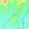
Foster Creek topographic map
Click on the map to display elevation.
About this map

Name: Foster Creek topographic map, elevation, terrain.
Location: Foster Creek, Madison County, North Carolina, United States (35.90200 -82.63292 35.94200 -82.59292)
Average elevation: 2,854 ft
Minimum elevation: 2,133 ft
Maximum elevation: 3,783 ft
Madison County trails, hiking, mountain biking, running and outdoor activities
Other topographic maps
Click on a map to view its topography, its elevation and its terrain.
Mars Hill
United States > North Carolina > Madison County
According to the United States Census Bureau, the town has a total area of 1.9 square miles (4.9 km2), all land. The town has an elevation of 2,330 feet (710 m), so the climate of the area is considerably cooler than might be expected of a town in a southern state.
Average elevation: 2,323 ft
Mars Hill
United States > North Carolina > Madison County
The town has an elevation of 2,330 feet (710 m), so the climate of the area is considerably cooler than might be expected of a town in a southern state.
Average elevation: 2,323 ft
Mars Hill
United States > North Carolina > Madison County
The town has an elevation of 2,330 feet (710 m), so the climate of the area is considerably cooler than might be expected of a town in a southern state.
Average elevation: 2,323 ft