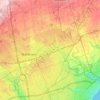
Milne Dam topographic map
Click on the map to display elevation.
About this map

Name: Milne Dam topographic map, elevation, terrain.
Location: Milne Dam, Markham, York Region, Ontario, L3P 1A3, Canada (43.86813 -79.26274 43.86875 -79.26108)
Average elevation: 594 ft
Minimum elevation: 515 ft
Maximum elevation: 666 ft
Other topographic maps
Click on a map to view its topography, its elevation and its terrain.

Rouge National Urban Park, Woodland Area
Canada > Ontario > York Region > Markham
Average elevation: 571 ft