Geolocate

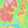
Sokna topographic map

Click on the map to display elevation.

About this map

Name: Sokna topographic map, elevation, terrain.

Location: Sokna, Ringerike, Viken, 3534, Norway (60.21984 9.90553 60.25984 9.94553)

Average elevation: 597 ft

Minimum elevation: 423 ft

Maximum elevation: 1,188 ft

Other topographic maps

Click on a map to view its topography, its elevation and its terrain.

Utøya

Norway > Viken

Average elevation: 292 ft

Ås

Norway > Viken

Average elevation: 322 ft

Konnerud

Norway > Viken

Average elevation: 810 ft

Lier

Norway > Viken

Average elevation: 928 ft

Storøyungen

Norway > Viken

Average elevation: 1,161 ft

Svelvik

Norway > Viken

Average elevation: 433 ft

Aspern

Norway > Viken

Average elevation: 430 ft

Rakkestad

Norway > Viken

Average elevation: 456 ft

Rauer

Norway > Viken

Average elevation: 7 ft

Ullensaker

Norway > Viken

Average elevation: 594 ft

Øvre Eiker

Norway > Viken

Average elevation: 1,007 ft

Gear up for your next adventure:

🎒Trail Energy Bars - High‑calorie bars for hiking energy
❄️Traction Cleats - Prevent slips on icy trails during winter hikes
📻Weather Alert Radios - Stay informed of storm risks while off-the-grid
👖Convertible Hiking Pants - Versatile zip-off pants for changing altitudes and temperatures
🎒Waterproof Dry Bags - Keep your electronics and maps dry inside your pack

As an Amazon Associate, this site earns from qualifying purchases at no extra cost to you.