Geolocate

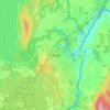
Konnerud topographic map

Click on the map to display elevation.

About this map

Name: Konnerud topographic map, elevation, terrain.

Location: Konnerud, Drammen, Viken, Norway (59.64053 10.00545 59.74229 10.21953)

Average elevation: 810 ft

Minimum elevation: -10 ft

Maximum elevation: 1,850 ft

Other topographic maps

Click on a map to view its topography, its elevation and its terrain.
Nesoddtangen

Norway > Viken

Average elevation: 69 ft

Hov

Norway > Viken

Average elevation: 367 ft

Varden

Norway > Viken

Average elevation: 3,940 ft

Råholt

Norway > Viken

Råholt is a village in the municipality of Eidsvoll, Norway. It is located at an average elevation of 189 meters above the sea level. Its population (2022) is 14,830.

Average elevation: 620 ft

Gjellestad

Norway > Viken

Average elevation: 112 ft

Sokna

Norway > Viken

Average elevation: 597 ft

Ørje

Norway > Viken

Average elevation: 472 ft

Greverud

Norway > Viken

Average elevation: 551 ft

Grani

Norway > Viken > Eltonåsen

Average elevation: 600 ft

Rauer

Norway > Viken

Average elevation: 7 ft

Drammen

Norway > Viken

Average elevation: 719 ft

Gear up for your next adventure:

🌧️Backpack Rain Cover - Keep gear dry in wet weather
🌡️Handheld Weather Meters - Measure wind, temp, and pressure for safe mountain travel
👓Polarized Sunglasses - Outdoor sunglasses for glare reduction
📦Gear Storage Bags - Organize and protect outdoor equipment
🪶Survival Guide Book - Expert advice for emergency preparedness

As an Amazon Associate, this site earns from qualifying purchases at no extra cost to you.