Geolocate

Gamèti topographic map

Click on the map to display elevation.

About this map

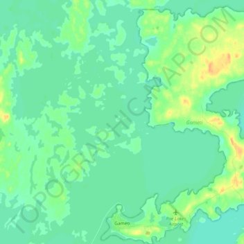
Name: Gamèti topographic map, elevation, terrain.

Location: Gamèti, North Slave Region, Northwest Territories, X0E 1R0, Canada (64.10590 -117.36741 64.18507 -117.22715)

Average elevation: 705 ft

Minimum elevation: 679 ft

Maximum elevation: 774 ft

Other topographic maps

Click on a map to view its topography, its elevation and its terrain.

Gear up for your next adventure:

🗃️Trail First Aid Kit - Essential kit for outdoor injuries and emergencies
🎒Hydration Pack - Hands‑free water reservoir for long hikes
🔋Rechargeable Batteries - Power up your outdoor devices
🪶Compact Camp Shovel - Folding shovel for campsite tasks
📱Heavy-Duty Phone Cases - Drop-proof and waterproof protection for outdoor navigation

As an Amazon Associate, this site earns from qualifying purchases at no extra cost to you.