
Waukegan topographic map
Interactive map
Click on the map to display elevation.
Waukegan
Waukegan is located at 42°22′13″N 87°52′16″W / 42.37028°N 87.87111°W / 42.37028; -87.87111 (42.3703140, −87.8711404). Waukegan is on the shore of Lake Michigan, about 11 miles (18 km) south of the border with Wisconsin and 37 miles (60 km) north of downtown Chicago at an elevation around 650 feet (200 m) above sea level. Chicago has two major streets that venture north to Waukegan, one being Sheridan Road, which extends north from Diversey Parkway in Lincoln Park. The second street is Milwaukee Avenue, which starts at the intersection of Desplaines Street and Kinzie Street in downtown Chicago.
About this map
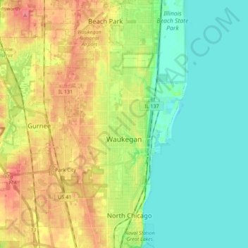
Name: Waukegan topographic map, elevation, terrain.
Location: Waukegan, Lake County, Illinois, United States (42.30938 -87.96442 42.43266 -87.80421)
Average elevation: 646 ft
Minimum elevation: 564 ft
Maximum elevation: 774 ft
Lake County trails, hiking, mountain biking, running and outdoor activities
Other topographic maps
Click on a map to view its topography, its elevation and its terrain.
Lake Naomi
United States > Illinois > Lake County > Hawthorn Woods > White Birch Lakes
Average elevation: 856 ft
Bishops Ridge
United States > Illinois > Lake County > Kildeer > Bishops Ridge
Average elevation: 830 ft