
Make a donation
Gear up for your next adventure:
As an Amazon Associate, this site earns from qualifying purchases at no extra cost to you.
Industry topographic map
Click on the map to display elevation.
Make a donation
Gear up for your next adventure:
As an Amazon Associate, this site earns from qualifying purchases at no extra cost to you.
About this map
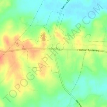
Name: Industry topographic map, elevation, terrain.
Location: Industry, Austin County, Texas, United States (29.95949 -96.51485 29.98255 -96.48075)
Average elevation: 302 ft
Minimum elevation: 230 ft
Maximum elevation: 387 ft
Austin County trails, hiking, mountain biking, running and outdoor activities
Make a donation
Gear up for your next adventure:
As an Amazon Associate, this site earns from qualifying purchases at no extra cost to you.
Other topographic maps
Click on a map to view its topography, its elevation and its terrain.
Stephen F. Austin State Park
United States > Texas > Austin County > San Felipe
Average elevation: 135 ft
Make a donation
Gear up for your next adventure:
As an Amazon Associate, this site earns from qualifying purchases at no extra cost to you.