
ناظور topographic map
Interactive map
Click on the map to display elevation.
About this map
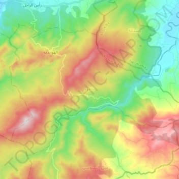
Name: ناظور topographic map, elevation, terrain.
Location: ناظور, معتمدية طبرقة, Jendouba, Tunisia (36.85434 8.85603 36.93926 9.00097)
Average elevation: 1,115 ft
Minimum elevation: 72 ft
Maximum elevation: 2,602 ft
Other topographic maps
Click on a map to view its topography, its elevation and its terrain.