
Yankee Hill topographic map
Interactive map
Click on the map to display elevation.
About this map
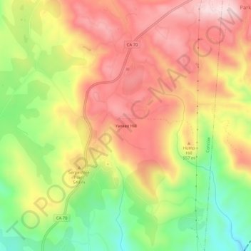
Name: Yankee Hill topographic map, elevation, terrain.
Location: Yankee Hill, Butte County, California, United States (39.68350 -121.54219 39.72350 -121.50219)
Average elevation: 1,677 ft
Minimum elevation: 981 ft
Maximum elevation: 2,260 ft
Butte County trails, hiking, mountain biking, running and outdoor activities
Other topographic maps
Click on a map to view its topography, its elevation and its terrain.