Geolocate

Durham topographic map

Click on the map to display elevation.

About this map

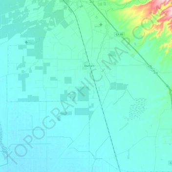
Name: Durham topographic map, elevation, terrain.

Location: Durham, Butte County, California, United States (39.53750 -121.90990 39.71325 -121.68870)

Average elevation: 167 ft

Minimum elevation: 92 ft

Maximum elevation: 807 ft

Butte County trails, hiking, mountain biking, running and outdoor activities

Other topographic maps

Click on a map to view its topography, its elevation and its terrain.

Dayton

United States > California > Butte County > Durham

Average elevation: 138 ft

Gear up for your next adventure:

🥄Camping Utensil Set - Lightweight utensils for outdoor meals
🧭Outdoor Navigation Book - Learn advanced navigation skills
🪶Camping Sleeping Pad - Comfortable sleeping pad for backpacking
👖Convertible Hiking Pants - Versatile zip-off pants for changing altitudes and temperatures
🔭Telescopic Hiking Pole - Adjustable pole for hiking stability

As an Amazon Associate, this site earns from qualifying purchases at no extra cost to you.