Geolocate

Grand Island topographic map

Click on the map to display elevation.

About this map

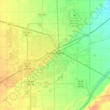
Name: Grand Island topographic map, elevation, terrain.

Location: Grand Island, Hall County, Nebraska, United States (40.85499 -98.43146 40.98888 -98.28821)

Average elevation: 1,860 ft

Minimum elevation: 1,804 ft

Maximum elevation: 1,913 ft

Hall County trails, hiking, mountain biking, running and outdoor activities

Gear up for your next adventure:

🌧️Backpack Rain Cover - Keep gear dry in wet weather
🧯Emergency Survival Kit - All‑in‑one survival essentials for the backcountry
⛑️Personal Locator Beacon - Safety beacon for emergencies
📷Action Camera - Capture your outdoor adventures in HD
🛌Ultralight Sleeping Bags - Compact down bags for cold nights in the wilderness

As an Amazon Associate, this site earns from qualifying purchases at no extra cost to you.