Geolocate

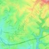
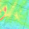
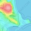
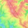
Shakespeare Drive Reserve topographic map

Click on the map to display elevation.

About this map

Name: Shakespeare Drive Reserve topographic map, elevation, terrain.

Location: Shakespeare Drive Reserve, St Clair, Sydney, New South Wales, 2759, Australia (-33.80311 150.78665 -33.80301 150.78675)

Average elevation: 167 ft

Minimum elevation: 98 ft

Maximum elevation: 282 ft

Other topographic maps

Click on a map to view its topography, its elevation and its terrain.
Wentworth Falls

Australia > New South Wales > Sydney

Wentworth Falls (postcode: 2782) is a town in the Blue Mountains region of New South Wales, situated approximately 100 kilometres (62 mi) west of the Sydney central business district, and about 8 kilometres (5.0 mi) east of Katoomba, Australia on the Great Western Highway, with a Wentworth Falls railway…

Average elevation: 2,323 ft
Sydney

Australia > New South Wales > Sydney

Average elevation: 75 ft

St Ives

Australia > New South Wales > Sydney

Average elevation: 410 ft

Penrith

Australia > New South Wales > Sydney > Penrith

Penrith is a city in New South Wales, Australia, located in Greater Western Sydney, 55 kilometres (31 mi) west of the Sydney central business district on the banks of the Nepean River, on the outskirts of the Cumberland Plain. Its elevation is 32 metres (105 ft).

Average elevation: 112 ft

Bents Basin State Conservation Area

Australia > New South Wales > Sydney

The park is popular for swimming, kayaking, bushwalking, camping (with 100 tent sites), barbecuing, picnicking and fishing. The park also features walking trails within a bushland and an education centre with a commercial kitchen. Caley's Lookout Track, a walking track within the bushland, leads to Little…

Average elevation: 269 ft
Northern Beaches

Australia > New South Wales > Sydney

Average elevation: 220 ft

Edensor Park

Australia > New South Wales > Sydney

Average elevation: 187 ft

Glenfield

Australia > New South Wales > Sydney

Average elevation: 95 ft

Roseville

Australia > New South Wales > Sydney

Average elevation: 276 ft

Allambie Heights

Australia > New South Wales > Sydney

Average elevation: 253 ft

Thornleigh

Australia > New South Wales > Sydney

Thornleigh is bounded to the north by Waitara Creek and south by the Lane Cove National Park. Thornleigh borders the suburbs of Normanhurst, Hornsby, Wahroonga, Westleigh and Pennant Hills. Thornleigh offers great district views, and the topography varies greatly with many established areas built around…

Average elevation: 522 ft

Kingsford

Australia > New South Wales > Sydney

Average elevation: 105 ft

Bondi Beach

Australia > New South Wales > Sydney

Average elevation: 102 ft

Waverton

Australia > New South Wales > Sydney

Average elevation: 108 ft

Camden Council

Australia > New South Wales > Sydney

Average elevation: 295 ft

Eastern Suburbs

Australia > New South Wales > Sydney

Average elevation: 39 ft

Baulkham Hills

Australia > New South Wales > Sydney

Average elevation: 305 ft

Eastwood

Australia > New South Wales > Sydney

Average elevation: 262 ft

Dundas Valley

Australia > New South Wales > Sydney

Average elevation: 240 ft

Picnic Point

Australia > New South Wales > Sydney

Average elevation: 79 ft

West Pymble

Australia > New South Wales > Sydney

Average elevation: 220 ft

Marrickville

Australia > New South Wales > Sydney

Average elevation: 56 ft

Inner West

Australia > New South Wales > Sydney

Average elevation: 62 ft

Turkeys Nest Reserve

Australia > New South Wales > Sydney

Average elevation: 187 ft

Mosman

Australia > New South Wales > Sydney

Average elevation: 95 ft

Wolli Creek

Australia > New South Wales > Sydney

Average elevation: 89 ft

Kemps Creek

Australia > New South Wales > Sydney

Average elevation: 187 ft

Mount Druitt

Australia > New South Wales > Sydney

Average elevation: 171 ft

Balgowlah Heights

Australia > New South Wales > Sydney

Average elevation: 82 ft

St Clair

Australia > New South Wales > Sydney

Average elevation: 157 ft

Abingdon Road Reserve

Australia > New South Wales > Sydney

Average elevation: 197 ft

North Curl Curl

Australia > New South Wales > Sydney

Average elevation: 72 ft

Carlingford

Australia > New South Wales > Sydney

Average elevation: 322 ft

Greystanes

Australia > New South Wales > Sydney

Average elevation: 174 ft

Cammeray

Australia > New South Wales > Sydney

Prior to the 1920s, the suburb was known as Suspension Bridge reflecting the now Long Gully Bridge that joined Northbridge to Cammeray. Cammeray was slow to develop mainly due to its steep topography and remoteness from transport.

Average elevation: 217 ft

Kurnell

Australia > New South Wales > Sydney

Average elevation: 13 ft

Mount Pritchard

Australia > New South Wales > Sydney

Average elevation: 112 ft

Badgerys Creek

Australia > New South Wales > Sydney

Average elevation: 289 ft

Holsworthy

Australia > New South Wales > Sydney

Average elevation: 397 ft

Dee Why

Australia > New South Wales > Sydney

Average elevation: 102 ft

Rose Bay

Australia > New South Wales > Sydney

Average elevation: 102 ft

Engadine

Australia > New South Wales > Sydney

Average elevation: 397 ft

Collaroy

Australia > New South Wales > Sydney

Average elevation: 79 ft

Vaucluse

Australia > New South Wales > Sydney

Average elevation: 66 ft

North Turramurra

Australia > New South Wales > Sydney

Average elevation: 446 ft

North Sydney

Australia > New South Wales > Sydney

Average elevation: 164 ft

Bilgola Beach

Australia > New South Wales > Sydney

Average elevation: 115 ft

Sydney Park

Australia > New South Wales > Sydney

Average elevation: 43 ft

Parramatta River

Australia > New South Wales > Sydney > Parramatta

Average elevation: 141 ft

South Penrith

Australia > New South Wales > Sydney > Penrith

Average elevation: 157 ft

Strathfield

Australia > New South Wales > Sydney

Average elevation: 85 ft

Warners Park

Australia > New South Wales > Sydney

Average elevation: 203 ft

North Balgowlah

Australia > New South Wales > Sydney

Average elevation: 184 ft

Yellow Rock

Australia > New South Wales > Sydney

Average elevation: 591 ft

Pendle Creek

Australia > New South Wales > Sydney

Average elevation: 141 ft

Mount Vernon

Australia > New South Wales > Sydney

Average elevation: 246 ft

Hunters Hill

Australia > New South Wales > Sydney

Average elevation: 79 ft

Tarban Creek

Australia > New South Wales > Sydney

Average elevation: 49 ft

Eagle Vale

Australia > New South Wales > Sydney

Average elevation: 266 ft

Lane Cove River

Australia > New South Wales > Sydney

Average elevation: 154 ft

Rhodes

Australia > New South Wales > Sydney

Average elevation: 20 ft

Scheyville

Australia > New South Wales > Sydney

Average elevation: 125 ft

Nielsen Park

Australia > New South Wales > Sydney

As is common in all coastal and estuarine areas of the Sydney Region, the Park contains many rock outcrops, particularly along the foreshore headlands. These are given some added interest by the remnants of the effect of a basalt dyke that runs from Mount Trefle to Bottle and Glass Point resulting in the…

Average elevation: 46 ft

Parramatta River

Australia > New South Wales > Sydney

Average elevation: 148 ft

Gadigal Green

Australia > New South Wales > Sydney

Average elevation: 85 ft

Scotland Island

Australia > New South Wales > Sydney

Average elevation: 56 ft

Woodford

Australia > New South Wales > Sydney

Woodford is a village in the Blue Mountains in New South Wales, Australia, about 90 kilometres west of Sydney. Its elevation is 609 metres (1,998 ft) above sea level. It is situated on the Great Western Highway and has a railway station (opened in 1868 as Buss's Platform) on the Main Western railway line…

Average elevation: 1,785 ft
Hurstville

Australia > New South Wales > Sydney

Average elevation: 164 ft

Rockdale

Australia > New South Wales > Sydney

Average elevation: 66 ft

Wicks Park

Australia > New South Wales > Sydney

Average elevation: 56 ft

Bella Vista

Australia > New South Wales > Sydney

Average elevation: 259 ft

Berkshire Park

Australia > New South Wales > Sydney

Average elevation: 89 ft

St Leonards

Australia > New South Wales > Sydney

Average elevation: 226 ft

Meadowbank Park

Australia > New South Wales > Sydney

Average elevation: 46 ft

Denistone West

Australia > New South Wales > Sydney

Average elevation: 180 ft

Nelson

Australia > New South Wales > Sydney

Average elevation: 154 ft

Beaconsfield

Australia > New South Wales > Sydney

Average elevation: 59 ft

Smithfield

Australia > New South Wales > Sydney

Established in 1836, Smithfield was the first major settlement of the Fairfield LGA. The original 1838 summary plan of Smithfield shows the suburb laid out in a grid pattern with most of the streets having the same names as they do today. Its altitude ranges from 21 to 48 m (69 to 157 ft) above sea level.…

Average elevation: 108 ft
Beaman Park

Australia > New South Wales > Sydney

Average elevation: 75 ft

Browns Waterhole

Australia > New South Wales > Sydney

Average elevation: 240 ft

Holroyd

Australia > New South Wales > Sydney

Average elevation: 79 ft

Valley Reserve

Australia > New South Wales > Sydney > Campbelltown

Average elevation: 335 ft

Richmond Lowlands

Australia > New South Wales > Sydney

Average elevation: 43 ft

Oyster Bay

Australia > New South Wales > Sydney

Average elevation: 82 ft

Killarney Heights

Australia > New South Wales > Sydney

Average elevation: 236 ft

Darlinghurst

Australia > New South Wales > Sydney

Average elevation: 125 ft

Macquarie Park

Australia > New South Wales > Sydney

Average elevation: 194 ft

Sans Souci

Australia > New South Wales > Sydney

Average elevation: 13 ft

Galston

Australia > New South Wales > Sydney

Average elevation: 548 ft

Marsfield

Australia > New South Wales > Sydney

Average elevation: 236 ft

Gregory Hills

Australia > New South Wales > Sydney

Gregory Hills is a suburb of Sydney in the state of New South Wales, Australia in Camden Council. The suburb was assigned on 1 August 2008. The suburb was named from the topography of the local area and from the original St Gregory's Chapel on the Marist Brothers land.

Average elevation: 358 ft
Oran Park

Australia > New South Wales > Sydney

Average elevation: 305 ft

Schofields

Australia > New South Wales > Sydney

Average elevation: 105 ft

Moorebank

Australia > New South Wales > Sydney

Average elevation: 39 ft

Killara

Australia > New South Wales > Sydney

Average elevation: 282 ft

Gear up for your next adventure:

🔭Stargazing Telescopes - Perfect for camping in low-light pollution areas shown on maps
🧢Outdoor Hiking Hat - Sun protection hat for outdoor explorers
🔪Outdoor Multitools - Essential survival tools for gear repair and field use
🗻Climbing Gear Basics - Essential gear for beginner climbers
🦟Ultrasonic Repellers - Create a bug-free zone at your camp or rest stop

As an Amazon Associate, this site earns from qualifying purchases at no extra cost to you.