Geolocate

Ponyri topographic map

Click on the map to display elevation.

About this map
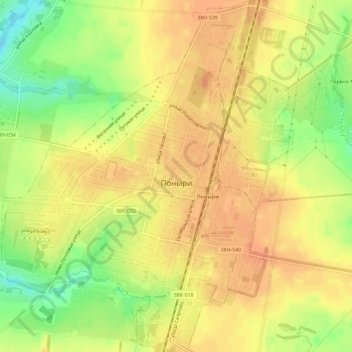
Name: Ponyri topographic map, elevation, terrain.

Location: Ponyri, Ponyrovsky District, Kursk Oblast, Central Federal District, 306000, Russia (52.30224 36.27289 52.33752 36.32131)

Average elevation: 797 ft

Minimum elevation: 712 ft

Maximum elevation: 840 ft

Other topographic maps

Click on a map to view its topography, its elevation and its terrain.

Снава

Russia > Kursk Oblast > Ponyrovsky District

Average elevation: 755 ft

Снава

Russia > Kursk Oblast > Ponyrovsky District

Average elevation: 755 ft

Gear up for your next adventure:

🗻Climbing Gear Basics - Essential gear for beginner climbers
🔋Rechargeable Batteries - Power up your outdoor devices
🪶Compact Camp Shovel - Folding shovel for campsite tasks
🪶Camp Gear Gift Set - Perfect gift bundle for outdoor fans
🔥Fast-Boil Camping Stoves - Efficient cooking systems for quick trail meals

As an Amazon Associate, this site earns from qualifying purchases at no extra cost to you.