
Make a donation
Gear up for your next adventure:
As an Amazon Associate, this site earns from qualifying purchases at no extra cost to you.
Baasrode topographic map
Click on the map to display elevation.
Make a donation
Gear up for your next adventure:
As an Amazon Associate, this site earns from qualifying purchases at no extra cost to you.
About this map
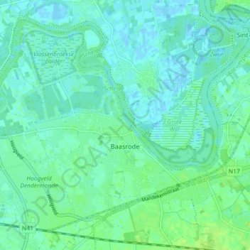
Name: Baasrode topographic map, elevation, terrain.
Location: Baasrode, Dendermonde, Oost-Vlaanderen, Vlaanderen, België (51.02089 4.12235 51.05870 4.19402)
Average elevation: 13 ft
Minimum elevation: -10 ft
Maximum elevation: 36 ft
Make a donation
Gear up for your next adventure:
As an Amazon Associate, this site earns from qualifying purchases at no extra cost to you.
Other topographic maps
Click on a map to view its topography, its elevation and its terrain.
Klein-Parijs
België > Oost-Vlaanderen > Dendermonde > Dendermonde > Sint-Gillis-bij-Dendermonde
Average elevation: 16 ft
Boonwijk
België > Oost-Vlaanderen > Dendermonde > Dendermonde > Sint-Gillis-bij-Dendermonde
Average elevation: 13 ft
Dendermonde
België > Oost-Vlaanderen > Dendermonde > Dendermonde
Dendermonde heeft een omvangrijk bouwkundig erfgoed. Hoogtepunten zijn de Lakenhalle (Stadhuis) en het Vleeshuis (Vleeshuismuseum) op de Grote Markt. Andere historische gebouwen zijn de Onze-Lieve-Vrouwekerk en de Hollandse Kazerne.
Average elevation: 13 ft
Make a donation
Gear up for your next adventure:
As an Amazon Associate, this site earns from qualifying purchases at no extra cost to you.
Camille Marchantplein
België > Oost-Vlaanderen > Dendermonde > Dendermonde > Sint-Gillis-bij-Dendermonde > Klein-Parijs
Average elevation: 16 ft
Make a donation
Gear up for your next adventure:
As an Amazon Associate, this site earns from qualifying purchases at no extra cost to you.