
Make a donation
Gear up for your next adventure:
As an Amazon Associate, this site earns from qualifying purchases at no extra cost to you.
Berlin topographic map
Click on the map to display elevation.
Make a donation
Gear up for your next adventure:
As an Amazon Associate, this site earns from qualifying purchases at no extra cost to you.
About this map
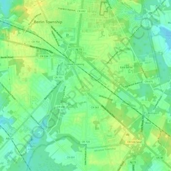
Name: Berlin topographic map, elevation, terrain.
Location: Berlin, Camden County, New Jersey, United States (39.77601 -74.96611 39.80915 -74.90796)
Average elevation: 161 ft
Minimum elevation: 125 ft
Maximum elevation: 194 ft
Camden County trails, hiking, mountain biking, running and outdoor activities
Make a donation
Gear up for your next adventure:
As an Amazon Associate, this site earns from qualifying purchases at no extra cost to you.
Other topographic maps
Click on a map to view its topography, its elevation and its terrain.
Bishops
United States > New Jersey > Camden County > Waterford Township > Atco
Average elevation: 154 ft
Downs Farms
United States > New Jersey > Camden County > Cherry Hill Township
Average elevation: 79 ft
Make a donation
Gear up for your next adventure:
As an Amazon Associate, this site earns from qualifying purchases at no extra cost to you.
Make a donation
Gear up for your next adventure:
As an Amazon Associate, this site earns from qualifying purchases at no extra cost to you.
Columbia Lakes
United States > New Jersey > Camden County > Cherry Hill Township
Average elevation: 56 ft
Charleston East
United States > New Jersey > Camden County > Cherry Hill Township
Average elevation: 75 ft
Haddon Towne
United States > New Jersey > Camden County > Cherry Hill Township
Average elevation: 66 ft
Make a donation
Gear up for your next adventure:
As an Amazon Associate, this site earns from qualifying purchases at no extra cost to you.
Stoys Landing
United States > New Jersey > Camden County > Cherry Hill Township
Average elevation: 46 ft
West Collingswood
United States > New Jersey > Camden County > Haddon Township
Average elevation: 23 ft
Andrews
United States > New Jersey > Camden County > Winslow Township > Sicklerville
Average elevation: 131 ft
Make a donation
Gear up for your next adventure:
As an Amazon Associate, this site earns from qualifying purchases at no extra cost to you.
Bishop Wood
United States > New Jersey > Camden County > Gloucester Township
Average elevation: 148 ft
Make a donation
Gear up for your next adventure:
As an Amazon Associate, this site earns from qualifying purchases at no extra cost to you.
Make a donation
Gear up for your next adventure:
As an Amazon Associate, this site earns from qualifying purchases at no extra cost to you.
Cherry Valley
United States > New Jersey > Camden County > Cherry Hill Township > Cherry Valley
Average elevation: 52 ft
Make a donation
Gear up for your next adventure:
As an Amazon Associate, this site earns from qualifying purchases at no extra cost to you.