Geolocate

Garbage Hill topographic map

Click on the map to display elevation.

About this map

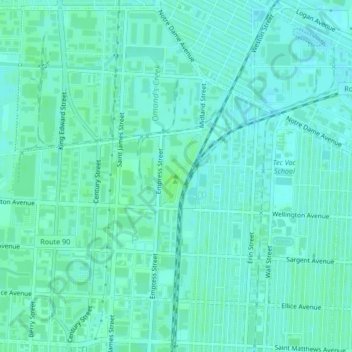
Name: Garbage Hill topographic map, elevation, terrain.

Location: Garbage Hill, Winnipeg, Manitoba, R3E 2Z9, Canada (49.90352 -97.19299 49.90362 -97.19289)

Average elevation: 774 ft

Minimum elevation: 761 ft

Maximum elevation: 791 ft

Other topographic maps

Click on a map to view its topography, its elevation and its terrain.

Assiniboine Forest

Canada > Manitoba > Winnipeg

Average elevation: 778 ft

Toilers Memorial Park

Canada > Manitoba > Winnipeg

Average elevation: 768 ft

Beaumont

Canada > Manitoba > Winnipeg

Average elevation: 768 ft

McKittrick Park

Canada > Manitoba > Winnipeg

Average elevation: 768 ft

Maple Grove Park

Canada > Manitoba > Winnipeg

Average elevation: 764 ft

Edgewood Park

Canada > Manitoba > Winnipeg

Average elevation: 768 ft

Bison Run

Canada > Manitoba > Winnipeg

Average elevation: 768 ft

Kings Park

Canada > Manitoba > Winnipeg

Average elevation: 764 ft

Gear up for your next adventure:

🧤Tactile Hiking Gloves - Keep hands warm while operating GPS and smartphone screens
🎒Day Hiking Backpack - Lightweight backpack perfect for day trips and outdoor adventures
📖Nature Tracking Books - Learn to track wildlife and terrain
⛑️Personal Locator Beacon - Safety beacon for emergencies
🗺️Topographic Maps - Detailed topo maps for hiking, exploring and outdoor navigation

As an Amazon Associate, this site earns from qualifying purchases at no extra cost to you.