Geolocate

Tea topographic map

Click on the map to display elevation.

About this map

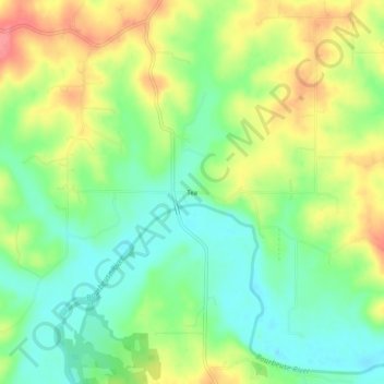
Name: Tea topographic map, elevation, terrain.

Location: Tea, Gasconade County, Missouri, United States (38.28005 -91.41654 38.32005 -91.37654)

Average elevation: 784 ft

Minimum elevation: 679 ft

Maximum elevation: 928 ft

Gasconade County trails, hiking, mountain biking, running and outdoor activities

Other topographic maps

Click on a map to view its topography, its elevation and its terrain.

Bland

United States > Missouri > Gasconade County

Average elevation: 928 ft

Owensville

United States > Missouri > Gasconade County

Average elevation: 915 ft

Hermann

United States > Missouri > Gasconade County

Average elevation: 623 ft

Gear up for your next adventure:

🔊Portable Camp Speaker - Music and alerts at camp
🥄Camping Utensil Set - Lightweight utensils for outdoor meals
Backpacking Tent - Lightweight and durable tent for multi‑day hikes
🖼️Topo Map Wall Art - Decorative topographic prints of famous peaks and regions
🛏️Cold Weather Sleeping Bag - Warm sleeping bag for cold conditions

As an Amazon Associate, this site earns from qualifying purchases at no extra cost to you.