
Frederick topographic map
Click on the map to display elevation.
About this map
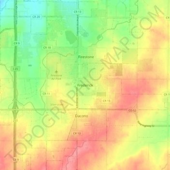
Name: Frederick topographic map, elevation, terrain.
Location: Frederick, Weld County, Colorado, 80530, United States (40.05915 -104.97720 40.13915 -104.89720)
Average elevation: 5,007 ft
Minimum elevation: 4,872 ft
Maximum elevation: 5,121 ft
Weld County trails, hiking, mountain biking, running and outdoor activities
Other topographic maps
Click on a map to view its topography, its elevation and its terrain.