Geolocate

Frederick topographic map

Click on the map to display elevation.

About this map

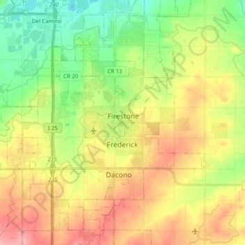
Name: Frederick topographic map, elevation, terrain.

Location: Frederick, Weld County, Colorado, United States (40.08038 -105.03757 40.13868 -104.88645)

Average elevation: 4,984 ft

Minimum elevation: 4,816 ft

Maximum elevation: 5,184 ft

Weld County trails, hiking, mountain biking, running and outdoor activities

Other topographic maps

Click on a map to view its topography, its elevation and its terrain.

Frederick

United States > Colorado > Weld County > Frederick

Average elevation: 5,007 ft

Gear up for your next adventure:

🌧️Backpack Rain Cover - Keep gear dry in wet weather
🔥Fast-Boil Camping Stoves - Efficient cooking systems for quick trail meals
🚑Emergency Bivvies - Heat-reflective sleeping bags for survival situations
📶Satellite Messenger - Communication device off‑grid
🥄Camping Utensil Set - Lightweight utensils for outdoor meals

As an Amazon Associate, this site earns from qualifying purchases at no extra cost to you.