Geolocate

Beauport topographic map

Click on the map to display elevation.

About this map

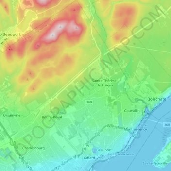
Name: Beauport topographic map, elevation, terrain.

Location: Beauport, Quebec City, Québec (Agglomération), Capitale-Nationale, Quebec, Canada (46.84388 -71.28514 46.96947 -71.13833)

Average elevation: 568 ft

Minimum elevation: -16 ft

Maximum elevation: 1,857 ft

Other topographic maps

Click on a map to view its topography, its elevation and its terrain.

Cap Diamant

Canada > Quebec > Quebec City

Average elevation: 92 ft

Gear up for your next adventure:

📷Action Camera - Capture your outdoor adventures in HD
🪶Survival Guide Book - Expert advice for emergency preparedness
🗃️Trail First Aid Kit - Essential kit for outdoor injuries and emergencies
🪓Survival Multi‑Tool - Versatile tool for camp and trail tasks
🪶Wildlife Field Guides - Learn animal tracking and species ID

As an Amazon Associate, this site earns from qualifying purchases at no extra cost to you.