Geolocate

Comer topographic map

Click on the map to display elevation.

About this map

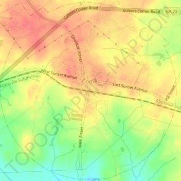
Name: Comer topographic map, elevation, terrain.

Location: Comer, Madison County, Georgia, United States (34.04762 -83.14434 34.07670 -83.10848)

Average elevation: 666 ft

Minimum elevation: 541 ft

Maximum elevation: 748 ft

Madison County trails, hiking, mountain biking, running and outdoor activities

Other topographic maps

Click on a map to view its topography, its elevation and its terrain.

Dogsboro

United States > Georgia > Madison County

Average elevation: 807 ft

Gear up for your next adventure:

🪶Trail Camera - Capture wildlife on your hikes
🚁Photography Drones - Capture stunning aerial views of landforms and topography
🪄Magnetic Compass - Accurate compass for navigation
💧Water Filtration Bottles - Safely drink from streams and lakes while exploring
🩹Survival Bandages - High‑quality bandages for emergencies

As an Amazon Associate, this site earns from qualifying purchases at no extra cost to you.