Geolocate

Dogsboro topographic map

Click on the map to display elevation.

About this map

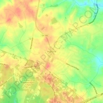
Name: Dogsboro topographic map, elevation, terrain.

Location: Dogsboro, Madison County, Georgia, 30646, United States (34.01206 -83.33571 34.05206 -83.29571)

Average elevation: 807 ft

Minimum elevation: 696 ft

Maximum elevation: 883 ft

Madison County trails, hiking, mountain biking, running and outdoor activities

Other topographic maps

Click on a map to view its topography, its elevation and its terrain.

Carlton

United States > Georgia > Madison County > Carlton

Average elevation: 561 ft

Ila

United States > Georgia > Madison County

Average elevation: 791 ft

Colbert

United States > Georgia > Madison County

Average elevation: 719 ft

Comer

United States > Georgia > Madison County

Average elevation: 666 ft

Hull

United States > Georgia > Madison County

Average elevation: 784 ft

Gear up for your next adventure:

🧼Biodegradable Camping Soap - Eco‑friendly soap for outdoor hygiene
🎒Waterproof Dry Bags - Keep your electronics and maps dry inside your pack
🧭Compass with Lanyard - Easy‑carry compass for navigation
🔪Outdoor Multitools - Essential survival tools for gear repair and field use
🥤Water Filter Bottle - All‑in‑one filter bottle for safe hydration

As an Amazon Associate, this site earns from qualifying purchases at no extra cost to you.