Geolocate

Edsbruk topographic map

Click on the map to display elevation.

About this map
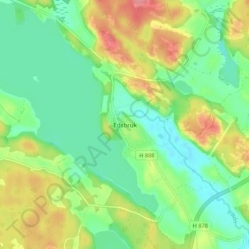
Name: Edsbruk topographic map, elevation, terrain.

Location: Edsbruk, Västerviks kommun, Kalmar County, 594 75, Sweden (57.99958 16.44746 58.03958 16.48746)

Average elevation: 105 ft

Minimum elevation: 0 ft

Maximum elevation: 276 ft

Gear up for your next adventure:

🖼️Topo Map Wall Art - Decorative topographic prints of famous peaks and regions
⛺Backpacking Tents - Weight-optimized shelters for multi-day topographic surveys
🪑Portable Camp Table - Compact table for campsite meals
📷Action Camera - Capture your outdoor adventures in HD
🎒Day Hiking Backpack - Lightweight backpack perfect for day trips and outdoor adventures

As an Amazon Associate, this site earns from qualifying purchases at no extra cost to you.