
Rice topographic map
Click on the map to display elevation.
About this map
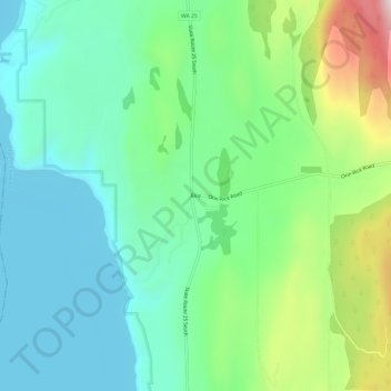
Name: Rice topographic map, elevation, terrain.
Location: Rice, Stevens County, Washington, 99167, United States (48.40878 -118.19027 48.44878 -118.15027)
Average elevation: 1,759 ft
Minimum elevation: 1,260 ft
Maximum elevation: 3,058 ft
Stevens County trails, hiking, mountain biking, running and outdoor activities
Other topographic maps
Click on a map to view its topography, its elevation and its terrain.