
Make a donation
Gear up for your next adventure:
As an Amazon Associate, this site earns from qualifying purchases at no extra cost to you.
Choctaw topographic map
Click on the map to display elevation.
Make a donation
Gear up for your next adventure:
As an Amazon Associate, this site earns from qualifying purchases at no extra cost to you.
About this map
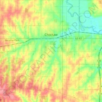
Name: Choctaw topographic map, elevation, terrain.
Location: Choctaw, Oklahoma County, Oklahoma, United States (35.42128 -97.33561 35.53668 -97.22092)
Average elevation: 1,188 ft
Minimum elevation: 1,070 ft
Maximum elevation: 1,322 ft
Oklahoma County trails, hiking, mountain biking, running and outdoor activities
Make a donation
Gear up for your next adventure:
As an Amazon Associate, this site earns from qualifying purchases at no extra cost to you.
Other topographic maps
Click on a map to view its topography, its elevation and its terrain.
Scissortail Park
United States > Oklahoma > Oklahoma County > Oklahoma City
Average elevation: 1,198 ft
Make a donation
Gear up for your next adventure:
As an Amazon Associate, this site earns from qualifying purchases at no extra cost to you.