Geolocate

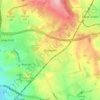
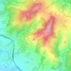
Belbroughton CP topographic map

Click on the map to display elevation.

About this map

Name: Belbroughton CP topographic map, elevation, terrain.

Location: Belbroughton CP, Bromsgrove, Worcestershire, England, United Kingdom (52.35733 -2.13787 52.40651 -2.03776)

Average elevation: 427 ft

Minimum elevation: 203 ft

Maximum elevation: 958 ft

Other topographic maps

Click on a map to view its topography, its elevation and its terrain.

Dodford

United Kingdom > England > Worcestershire > Bromsgrove

Average elevation: 381 ft

Rubery

United Kingdom > England > Worcestershire > Bromsgrove

Average elevation: 699 ft

Cobley Hill

United Kingdom > England > Worcestershire > Bromsgrove

Average elevation: 502 ft

Blackwell

United Kingdom > England > Worcestershire > Bromsgrove > Blackwell

Average elevation: 531 ft

Hopwood

United Kingdom > England > Worcestershire > Bromsgrove

Average elevation: 525 ft

Lickey End

United Kingdom > England > Worcestershire > Bromsgrove

Average elevation: 472 ft

Rednal Hill

United Kingdom > England > Worcestershire > Bromsgrove

Average elevation: 705 ft

Stoke Pound

United Kingdom > England > Worcestershire > Bromsgrove

Average elevation: 282 ft

Inkford

United Kingdom > England > Worcestershire > Bromsgrove > Wythall CP

Average elevation: 525 ft

Catshill

United Kingdom > England > Worcestershire > Bromsgrove

Average elevation: 495 ft

Clent Hills

United Kingdom > England > Worcestershire > Bromsgrove > Clent

Average elevation: 689 ft

Gear up for your next adventure:

🔭Compact Binoculars - HD vision for scouting terrain and identifying distant landmarks
🎒Trail Energy Bars - High‑calorie bars for hiking energy
🛡️Insect Repellent - Protection against bugs during outdoor activities
🔭Stargazing Telescopes - Perfect for camping in low-light pollution areas shown on maps
🌡️Portable Weather Meter - Track weather conditions on the trail

As an Amazon Associate, this site earns from qualifying purchases at no extra cost to you.