
Moyie topographic map
Click on the map to display elevation.
About this map
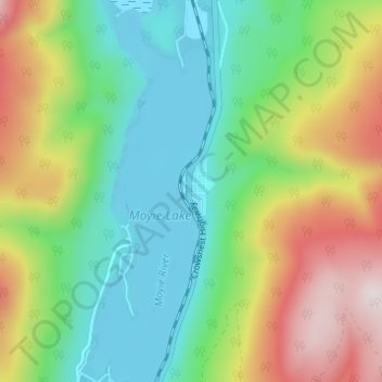
Name: Moyie topographic map, elevation, terrain.
Average elevation: 3,819 ft
Minimum elevation: 3,035 ft
Maximum elevation: 5,276 ft
Other topographic maps
Click on a map to view its topography, its elevation and its terrain.
Monroe Lake
Canada > British Columbia > Regional District of East Kootenay > Area C (Moyie/Bull River)
Average elevation: 3,625 ft
Moyie Lake
Canada > British Columbia > Regional District of East Kootenay > Area C (Moyie/Bull River) > Moyie
Average elevation: 3,888 ft
Jim Smith Lake
Canada > British Columbia > Regional District of East Kootenay > Area C (Moyie/Bull River)
Average elevation: 3,579 ft