
Thank you for supporting this site ❤️
Make a donation
Make a donation
Gear up for your next adventure:
As an Amazon Associate, this site earns from qualifying purchases at no extra cost to you.
Elgin topographic map
Click on the map to display elevation.
Thank you for supporting this site ❤️
Make a donation
Make a donation
Gear up for your next adventure:
As an Amazon Associate, this site earns from qualifying purchases at no extra cost to you.
About this map
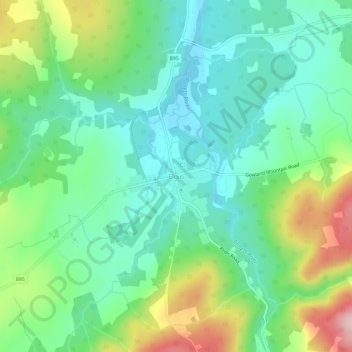
Name: Elgin topographic map, elevation, terrain.
Location: Elgin, Elgin Parish, Albert County, New Brunswick, Canada (45.77708 -65.12898 45.81708 -65.08898)
Average elevation: 518 ft
Minimum elevation: 269 ft
Maximum elevation: 1,076 ft
Thank you for supporting this site ❤️
Make a donation
Make a donation
Gear up for your next adventure:
As an Amazon Associate, this site earns from qualifying purchases at no extra cost to you.