
Thank you for supporting this site ❤️
Make a donation
Make a donation
Gear up for your next adventure:
As an Amazon Associate, this site earns from qualifying purchases at no extra cost to you.
Brooks topographic map
Click on the map to display elevation.
Thank you for supporting this site ❤️
Make a donation
Make a donation
Gear up for your next adventure:
As an Amazon Associate, this site earns from qualifying purchases at no extra cost to you.
About this map
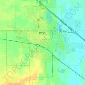
Name: Brooks topographic map, elevation, terrain.
Location: Brooks, City of Brooks, Alberta, Canada (50.54286 -111.92915 50.58660 -111.84309)
Average elevation: 2,487 ft
Minimum elevation: 2,444 ft
Maximum elevation: 2,549 ft
Thank you for supporting this site ❤️
Make a donation
Make a donation
Gear up for your next adventure:
As an Amazon Associate, this site earns from qualifying purchases at no extra cost to you.