Geolocate

Mexi topographic map

Click on the map to display elevation.

About this map

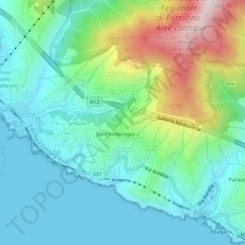
Name: Mexi topographic map, elevation, terrain.

Location: Mexi, Sant'Ambrogio, Zoagli, Genoa, Liguria, 16035, Italy (44.33661 9.24450 44.35661 9.26450)

Average elevation: 522 ft

Minimum elevation: 0 ft

Maximum elevation: 1,982 ft

Gear up for your next adventure:

🦺Reflective Outdoor Gear - Safety gear for low‑light conditions
🌄Hiking Binoculars - Compact binoculars for scenic views and trail spotting
🛶Inflatable Kayak - Portable kayak for rivers, lakes, and expeditions
🔦Compact Flashlight - Reliable flashlight for emergencies
📦Dry Bags Set - Waterproof storage for electronics and clothes

As an Amazon Associate, this site earns from qualifying purchases at no extra cost to you.