Geolocate

Demopolis topographic map

Click on the map to display elevation.

About this map

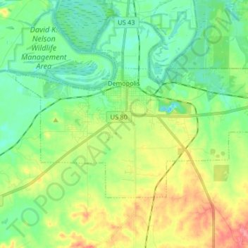
Name: Demopolis topographic map, elevation, terrain.

Location: Demopolis, Marengo County, Alabama, 36732, United States (32.46595 -87.89487 32.53282 -87.76197)

Average elevation: 135 ft

Minimum elevation: 36 ft

Maximum elevation: 331 ft

Marengo County trails, hiking, mountain biking, running and outdoor activities

Other topographic maps

Click on a map to view its topography, its elevation and its terrain.

Hugo

United States > Alabama > Marengo County

Average elevation: 167 ft

Dayton

United States > Alabama > Marengo County

Average elevation: 207 ft

Gear up for your next adventure:

🎒Trekking Poles - Sturdy poles for balance and stability on rough terrain
🎒Waterproof Dry Bags - Keep your electronics and maps dry inside your pack
🪄Magnetic Compass - Accurate compass for navigation
🚪Portable Camp Chair - Foldable chair for comfort at camp
😴Insulated Sleeping Pads - Compact and warm pads for high-elevation camping

As an Amazon Associate, this site earns from qualifying purchases at no extra cost to you.