
Thank you for supporting this site ❤️
Make a donation
Make a donation
Gear up for your next adventure:
As an Amazon Associate, this site earns from qualifying purchases at no extra cost to you.
Manahari topographic map
Click on the map to display elevation.
Thank you for supporting this site ❤️
Make a donation
Make a donation
Gear up for your next adventure:
As an Amazon Associate, this site earns from qualifying purchases at no extra cost to you.
About this map
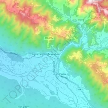
Name: Manahari topographic map, elevation, terrain.
Location: Manahari, Makwanpur, Bagmati Province, Nepal (27.50075 84.76556 27.58075 84.84556)
Average elevation: 1,562 ft
Minimum elevation: 869 ft
Maximum elevation: 3,740 ft
Thank you for supporting this site ❤️
Make a donation
Make a donation
Gear up for your next adventure:
As an Amazon Associate, this site earns from qualifying purchases at no extra cost to you.